
The UN weather agency says El Niño is now near-certain to run through February 2027 and may be the strongest ever measured, with Pacific waters 2.6C above normal and subsurface temperatures 8C above average
The World Meteorological Organization has expressed the highest confidence it has ever put in an El Niño forecast. The reason is not a model projection — it is heat already sitting below the surface of the Pacific that has not yet come up. Indonesia's peat fires, 50,000 respiratory infections and a haze reaching four countries are the first instalment.
Forecasting agencies do not say one hundred per cent. The language of a seasonal outlook is normally a careful ladder of likelihoods. So the most significant thing the World Meteorological Organization said in Geneva on Thursday was not that El Niño is intensifying. It was the number attached to the claim: an exceptionally high likelihood of nearly 100 per cent that El Niño will run through February — the strongest certainty the agency says it has ever expressed in an El Niño/La Niña update.
Behind that language is a warning that the event now building may exceed anything in the modern record, with effects on rainfall, agriculture and energy running well into 2027. WMO Secretary-General Celeste Saulo said it would peak toward the end of this year.
If this trajectory continues, it may be stronger than anything since our monitoring began — so literally off the charts we have used for the past four decades. — Celeste Saulo, Secretary-General, World Meteorological Organization
The measurement that makes the forecast confident
An El Niño is declared when sea surface temperatures in the central and eastern equatorial Pacific run 0.5C above the long-term average. That is the entry threshold. The current readings are nowhere near it.
The WMO's index averaged 1.5C above normal between May and July. Weekly values from late July to mid-August ran between 2.2C and 2.6C above average, indicating the event was still strengthening rather than levelling off. The agency grades events on a four-step scale — weak, moderate, strong, very strong — and expects this one to reach the top step.
But the figure explaining the agency's confidence is not a surface figure at all. Below the surface, the WMO recorded ocean temperatures more than 8C above average during July and early August.
Heat already in the upper ocean is not a projection. It is an inventory. In an El Niño the warm subsurface water propagates eastward and upwards, so an anomaly measured at depth in August is the fuel for surface conditions in the months that follow. The WMO is not extrapolating a trend line and hoping it holds — it is observing a reservoir of heat that has to surface somewhere. That is why a seasonal forecast, normally the most hedged product in meteorology, can be stated at near-certainty.
Why the temperature record is a 2027 story
There is a lag of about a year between an El Niño peak and its effect on global average temperature. Ocean heat releases into the atmosphere slowly, pushing up global temperatures the following calendar year rather than the current one; the 2023-24 event contributed to 2024 finishing as the warmest year on record.
So the peak arrives around the end of 2026 and the temperature consequence lands in 2027. Asked whether the record would fall again, Saulo said: "we should not be surprised if this record is broken".
One distinction the WMO insists on deserves repeating, because coverage routinely collapses it. El Niño is a naturally occurring oscillation that has run every two to seven years for as long as anyone has measured it, and it is not caused by climate change. What it does is arrive on top of a baseline that fossil fuel burning has already raised. The oscillation supplies the swing; the warming supplies the floor it swings from.
Indonesia is not a forecast
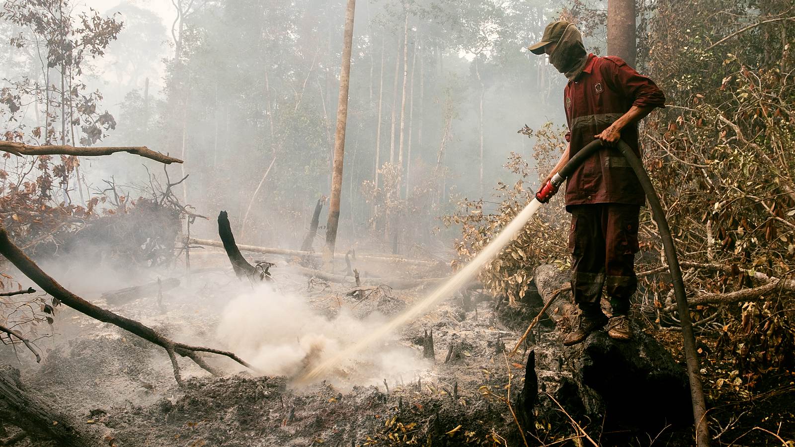
For one region the warning is already retrospective. Toxic haze is covering parts of Indonesia and drifting into Malaysia, Singapore and the Philippines, produced by fires burning across Sumatra and Indonesian Borneo since mid-July. In places the pollution has reached more than fifteen times the level the World Health Organization considers safe.
Indonesia's Health Ministry recorded over 50,000 cases of respiratory infection linked to land and forest fires between July and August. More than 12,000 of those cases were in children under the age of five.
Rizma Nur Fatimah, a 19-year-old teaching assistant in Banjarbaru, South Kalimantan, told the BBC the smog inside her classroom had become so thick that "you couldn't even see your own feet". Her account of the annual haze is its own kind of data point: "It's the same every year, so we've almost become resigned to it. But this year is worse." Some 1,300 kilometres away in the Philippine province of Palawan, residents report itchy eyes and headaches; Malaysia has reported rising asthma and conjunctivitis.
Why peat is the whole problem
It would be wrong to lay Indonesia's fire seasons entirely at El Niño's door. Researchers and government investigations have long tied the severity of the burning to decades of land-use change — drainage of peatland for oil palm and industrial timber, and fire as a cheap method of clearing. What El Niño supplies is the drought that turns a managed practice into an uncontrollable one.
The reason that combination is so destructive lies in what peat is. "Peatlands are incredibly effective carbon stores because their waterlogged conditions slow decomposition, allowing carbon to accumulate underground for thousands of years," said Dr Nisa Novita, a peatland researcher at the Indonesian NGO Yayasan Konservasi Alam Nusantara. "But this also means they can become a 'carbon bomb' when they are drained or burned."
The operational consequence is that a peat fire is not a forest fire. It burns downward, in organic matter below the surface, insulated from wind and from water applied above it. Waterlogging is the only thing that reliably prevents it — precisely what drainage for plantations removes, and what an El Niño drought removes again by lowering the water table. A crew hosing a smouldering surface is holding the fire's edge rather than extinguishing it. This is why these fires run for months, and resume in the same places year after year.
The scale that implies is stark. Professor Bambang Hero Saharjo, a forest fire forensics expert at Institut Pertanian Bogor University, told the BBC that last year — without El Niño — fires in Indonesia burned about 359,000 hectares. Citing research reports, he said this year's could burn as much as 11 million hectares, putting it alongside the catastrophic 1997-98 season. Indonesia's forestry minister, Raja Juli Antoni, was blunt: "September is the peak of El Niño. September is the main fight for us."
How it reaches everyone else
The transmission channel to the rest of the world is commodities: Asia-Pacific and Latin America take the physical impact, and everyone else meets it through corn, cocoa, coffee and energy.
Specific damage is already logged. Guatemala, Honduras and El Salvador have seen drought and erratic conditions that an August Oxfam report linked to El Niño, producing severe crop losses. A weaker monsoon in India is expected to hit rice, sugar, cotton and soybean. In Peru, officials say anchovy fishing has taken a devastating blow — and because Peruvian anchovy is processed into feed rather than eaten, that is a livestock-cost story, and therefore a meat price story, long before it is a fish story.
Energy is the channel markets tend to underweight, because the effect is not directional. Extreme weather is expected to disrupt hydropower, wind and solar output, oil and gas production, refining and mining — in different places, in different directions, at different times. For a commodity desk, a very strong El Niño is not a view on price. It is an increase in variance across almost every physical input at once.
The case for not panicking
The strongest counter-argument is that this is a known quantity. El Niño recurs every two to seven years and typically lasts nine months to a year. The world has absorbed very strong events before, including the 1997-98 season now invoked as the comparison. Forecast skill has improved substantially since then, and the warning is itself a form of mitigation: Saulo put disaster management authorities and the agriculture, health, energy and water sectors on notice with months of lead time, saying there was "no time to lose". A hazard visible in September is a different hazard from one that arrives unannounced in December.
The case for concern does not dispute that, only the arithmetic of where it starts. The same oscillation now runs on top of a hotter ocean than the last comparable event, and the WMO's certainty language — unprecedented in this product — suggests the agency thinks the upper bound is unmapped. UN Secretary-General António Guterres framed it as a race: "The world is in the danger zone of extreme weather. The race now is between rising risks and our commitment to take climate action and protect people. We must win that race."
What holds
The measurements are the part that will not be revised away: a Pacific index running 2.2C to 2.6C above average against a 0.5C threshold, subsurface temperatures more than 8C above average, near-certainty of continuation through February, and fires burning in Sumatra and Borneo since mid-July.
The durable point is the one buried in the subsurface figure. The reason this forecast can be stated with unusual confidence is that most of the heat driving it has already been deposited and simply has not surfaced yet. That is the bad news and the good news in a single measurement: the event is close to locked in, and everyone who needs to prepare for it has been told months before it peaks.
This report is based on the World Meteorological Organization's El Niño/La Niña update issued in Geneva on 3 September 2026 and remarks by WMO Secretary-General Celeste Saulo and UN Secretary-General António Guterres, together with reporting by CNBC, Al Jazeera and the BBC published the same day, and figures attributed to Indonesia's Health Ministry and an August 2026 Oxfam report. The projection of up to 11 million hectares burned is an estimate cited by Professor Bambang Hero Saharjo from research reports, not an official government forecast, and is subject to how the remainder of the fire season develops. Seasonal forecasts are probabilistic; the WMO's stated near-certainty applies to the continuation of El Niño conditions through February, not to any particular regional outcome.