
A flash flood at the bottom of the Grand Canyon killed one man and left 15 unaccounted for — and destroyed both of the only footbridges across the Colorado River
Sixty-two people were airlifted out of Phantom Ranch and the lower North Kaibab trail. The Black Bridge and the Silver Bridge are gone, along with nearly every footbridge on Bright Angel Creek, and the South Rim has stopped taking overnight guests because the water system failed.
The detail that explains why Saturday's flood at the bottom of the Grand Canyon is still unfolding three days later is not the death toll. It is that the two bridges are gone.
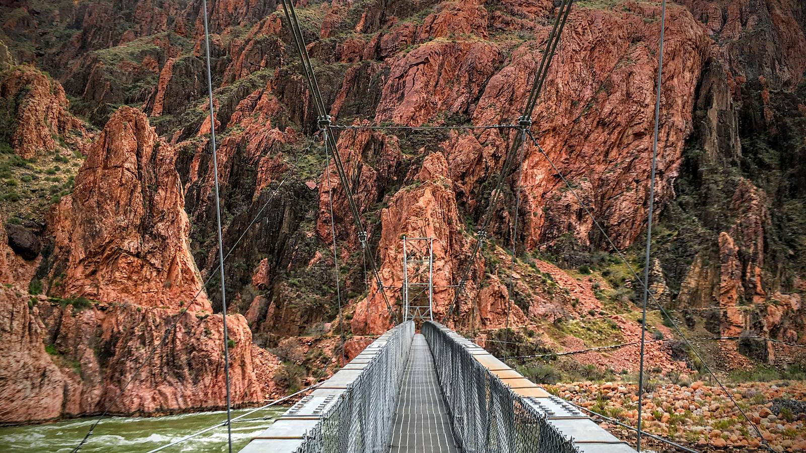
The Black Bridge and the Silver Bridge are the only footbridges across the Colorado River inside Grand Canyon National Park. Both were destroyed when a flash flood tore down Bright Angel Canyon and through the Phantom Ranch area on Saturday afternoon, according to the National Park Service. Nearly all of the footbridges crossing Bright Angel Creek went with them. The flood propelled boulders downstream and closed multiple trails.
One person is confirmed dead. The body of a 46-year-old man was recovered on Sunday evening near Crystal Rapids along the Colorado River, the park service told CBS News. Fifteen people remain missing or unaccounted for. Sixty-two have been airlifted out — evacuated by the Arizona Department of Public Safety and the park service from Phantom Ranch and the lower North Kaibab trail up to the South Rim.
Why the inner canyon is a different kind of trap
A flash flood in a canyon system does not behave like a river flood, and the difference is what kills people. Rain falling on a plateau many miles away is funnelled by the drainage into a narrow channel, arriving somewhere downstream that may have seen no rain at all. There is often no local warning, because there is often no local weather.
What arrives is not water. It is a debris flow — water carrying sediment, rock and vegetation at a density closer to wet concrete than to a river. That is the mechanism behind the boulders the park service described moving downstream, and behind bridges failing rather than merely flooding. A structure engineered to stand above a rising creek is not engineered to be struck by rock travelling at the speed of the water.
The inner canyon compounds it. There is no high ground in the ordinary sense, and no way out on foot that does not involve climbing a vertical mile. Nikki Baggs, 41, who was airlifted out with two friends, described the sequence to the BBC: they had just dropped their belongings at a cabin at Phantom Ranch and gone out to enjoy the weather when the rain hit. They moved to higher ground and sat at a picnic table. Rangers then shouted at them to run again, to a different ledge, where they waited for hours.
It was a beautiful day and then people were screaming, running.
They were evacuated at about half past nine that night. From the ledge, Baggs said, they watched the bridges being swept away. She credited the rangers without reservation: "It was a really uniquely coordinated effort. That's what made us feel safe about all of it in an unsafe situation."
The evacuation numbers make the geography concrete. Sixty-two people had to be lifted out by helicopter from a location that, on a normal day, is reached by walking seven to ten miles downhill and descending about 4,500 feet. Phantom Ranch sits at the bottom of that descent — a cluster of stone cabins and dormitories, reachable on foot, by mule or by raft, and by nothing else. When the crossings failed, helicopter became the only way out for everyone below the rim, in weather that was still producing the storms that caused the flood.
The bridges are infrastructure, not scenery
Losing both river crossings does more than inconvenience hikers. The corridor that runs from the South Rim down the Bright Angel and South Kaibab trails, across the river and up the North Kaibab is the park's spine — the route by which rangers, mules, supplies and rescue teams move through the inner canyon. Without a crossing, the north and south halves of that system are severed for anyone not in a helicopter.
The Silver Bridge carries something else as well: the trans-canyon pipeline, the line that moves water from Roaring Springs on the north side of the canyon to the developed South Rim. The park service has reported extensive damage to the park's water infrastructure and has suspended overnight lodging at the South Rim from Monday until further notice. It has not published a full account of what failed where, but the pipeline's route across the destroyed bridge is a matter of record.
That is the difference between a closure and a shutdown. A trail can reopen when the debris is cleared. A water system serving a rim that receives a large share of roughly five million annual visitors cannot be improvised, and the pipeline it depends on has a long history of breaks even in ordinary years.
The monsoon, and why it is hard to forecast
The rain came from the North American monsoon. Each summer a shift in wind direction pulls warm, moist air northward from the Gulf of California and the tropical Pacific over the Southwest, where it rises against mountainous terrain and builds into thunderstorms.
These storms are notoriously difficult to place in advance. They are small, they are convective, and they form and collapse over a few hours — which means a forecast can be entirely correct about the day and entirely useless about the drainage. The ground makes it worse rather than better: sun-baked desert soil sheds water instead of absorbing it, so a downpour that a temperate catchment would soak up runs straight off into the channel.
The same physics carries a second hazard. Monsoon storms bring frequent lightning onto terrain that has been drying all summer, which is why the season that produces the region's flash floods is also the season that starts a large share of its wildfires. The Southwest spends August exposed to both at once, and often to the compound version — a burn scar that then sheds water even faster than the desert soil it replaced.
Flood watches currently cover large parts of Arizona along with New Mexico, Utah and Colorado. The park service warned that further thunderstorms and heavy rainfall on Sunday and Monday could bring additional flash flooding, debris flows, rockfall and changing trail and river conditions. The monsoon season normally runs to the end of September, which means the hazard that produced Saturday's flood is not a passing event but the prevailing condition for another month.
The number that has not settled
The figure of 15 missing deserves care. The park service has said it is seeking information about 15 people thought to be missing or unaccounted for, and has asked anyone who knew of hikers or backpackers in the inner canyon along the Bright Angel Creek corridor on Saturday to make contact.
That phrasing — missing or unaccounted for — covers two very different situations. Some of those people may be dead. Others may have walked out on a different trail, or never entered the canyon at all, and simply have not yet been matched against a permit or a reservation. In the backcountry, the roster is assembled from permits, lodge bookings and third-party reports, and it is normal for such a list to shrink substantially as people are located. It is also the reason the park is appealing publicly rather than waiting: reconciling the list is how the search gets narrowed.
What this does not tell us
It is worth resisting the pull toward a tidy explanation. A single monsoon flash flood is not evidence of anything about long-run climate on its own; the North American monsoon has produced lethal floods in this canyon for as long as records exist, including a major flood down Bright Angel Creek in 1966 that also rebuilt the channel. Attribution requires trends, not incidents.
What can be said without stretching is narrower and more useful. The park's inner-canyon corridor has a small number of single points of failure, and this flood found two of them in an afternoon. The bridges were not redundant. The pipeline was not redundant. A park that receives millions of visitors a year runs its most remote and least escapable section on infrastructure that a sufficiently large debris flow can remove in minutes.
The durable question is not whether the trails reopen — they will. It is what the corridor gets rebuilt as. The Black Bridge has stood since the 1920s and the Silver Bridge since the 1960s, and both were built for a park with a fraction of today's traffic and for a hydrology that forecasters now describe in terms of storms they cannot pinpoint. Whatever replaces them will be the answer to a question the park has not yet had to ask.
This report is based on National Park Service statements as reported by BBC News, CBS News, NPR and KJZZ, and on eyewitness comments given to the BBC. Casualty and missing-person figures in the first days of an incident of this kind are provisional and have been revised repeatedly in comparable events; the count of 15 includes people unaccounted for who may yet be located unharmed. The park service has not published a detailed assessment of the water-system damage, and the relationship between the destroyed Silver Bridge and the trans-canyon pipeline is stated here from the pipeline's documented route, not from an official finding.