
Trump signs an executive order renaming Lake Ontario 'Lake America' — over a lake whose far shore, and whose 400-year-old name, belong to Canada
The order directs the Interior Department to strike a name that predates both countries from federal maps, in the middle of an escalating tariff war with Ottawa. Canada's Prime Minister Mark Carney says the answer is simple: 'Naming reality means calling it Lake Ontario.' New York's governor won't use the new name either.
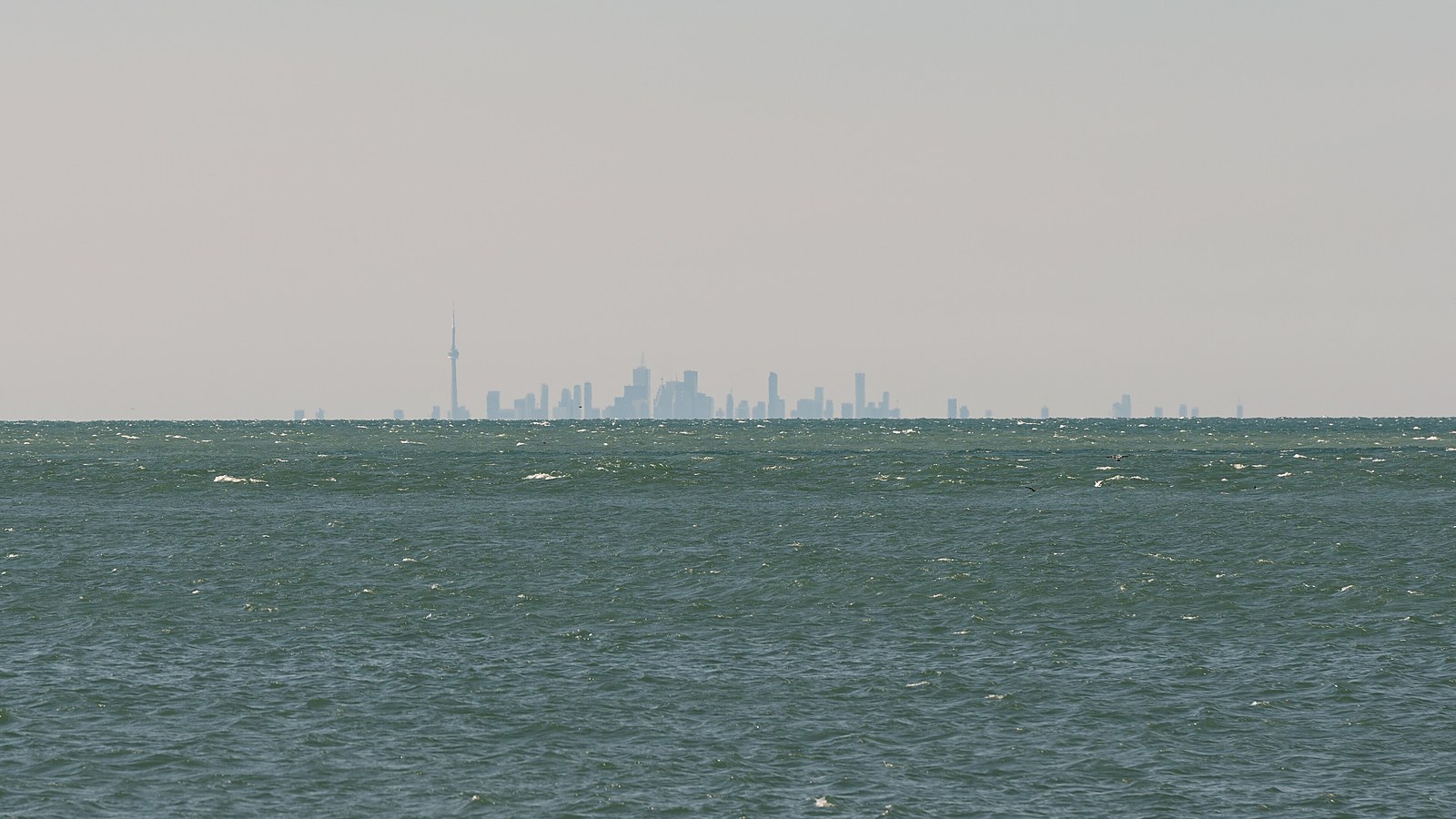
As of Thursday afternoon, the United States federal government no longer recognises a body of water called Lake Ontario. President Trump signed an executive order in the Oval Office renaming it "Lake America" — a change that applies, in any binding sense, only to the roughly half of the lake that sits in American waters, and only to the American government's own maps. The other shore belongs to a country that has already said it will not be using the name.
"We're going to be changing the name of Lake Ontario, effective immediately, to Lake America," the president said before signing the order, according to CBS News. The signing made good on a threat he issued on Truth Social earlier in the week, when he said the US was giving "serious consideration" to the change and posted a map with the label "Lake Ontario" crossed out — adding that the US does not expect to be "doing much business with Ontario any longer."
The mechanics are narrower than the announcement. The order directs Interior Secretary Doug Burgum to update the Geographic Names Information System, the federal database that — together with the US Board on Geographic Names — standardises place names for federal use. Within hours, the president posted a letter from the director of the US Geological Survey confirming the change had been made and would "begin occurring in printed documents over the next several days."
That is the full legal reach of the instrument. The GNIS binds federal agencies: their maps, charts, signage and publications. It does not bind other countries, international bodies, state governments, private mapmakers or anyone else — a limit the White House itself acknowledged when the same tool was used on the Gulf of Mexico.
The system being repurposed here was built for a much duller job. Federal names databases exist so that a topographic map, a nautical chart and a census table all agree on what a place is called — a bureaucratic housekeeping function that was never designed to carry foreign policy. That is why the order works instantly inside the government and not at all outside it: the president is not renaming a lake so much as editing a database that federal publications are required to copy from.
A name older than either country
"The name Lake Ontario comes from the Wendat word 'Ontari'io,' which, appropriately, means, 'the lake is beautiful, the lake is big,'" Canadian Prime Minister Mark Carney said. "Canadians also know that naming reality means calling it Lake Ontario — then, now and always."
Carney's response leaned on the one fact no executive order can amend: the name is more than 400 years old, predating Canadian Confederation and the American Declaration of Independence alike. His statement carried an unmistakable edge, cataloguing what he described as an America busy changing "their trading relationships, their foreign policies, their national monuments, their hydronyms."
The rejection is not confined to Ottawa. In New York — the only US state with a shoreline on the lake — Democratic Governor Kathy Hochul was blunter still: "New York won't be calling it that." The state's position matters practically, because state agencies, not federal ones, produce most of the signage, tourism material and local documentation that residents on the American side actually encounter. A driver reaching the water at Rochester or Oswego will see whatever New York chooses to print, and New York has chosen. The result, on the American shore itself, is a lake with a federal name its own state government declines to use.
Geography compounds the awkwardness. The international boundary runs through the middle of the lake, which means the United States has renamed, at most, its half — while ships crossing the line will pass, on paper, from Lake America into Lake Ontario and back again. Toronto, the largest city on its shores, sits on the side where the order has no force whatsoever.
The tariff war behind the map
The order did not arrive in a vacuum. On Saturday, 50 per cent US tariffs took effect on a range of Canadian imports including wine and dairy. On Monday, the president announced 50 per cent tariffs on all Canadian steel and automotive imports, to take effect in January. Carney has answered in kind: beginning September 8, Canada will impose matching tariffs of up to 50 per cent on billions of dollars of American goods.
The automotive tariff is the one with real weight behind it. The North American car industry has operated as a single continental system for decades, with parts and part-finished vehicles crossing the US-Canada border repeatedly before a car is complete — which means a 50 per cent tariff at that border does not tax a foreign product once, it taxes a shared production line at every crossing. Against economic measures of that scale, a renamed lake is the cheapest possible round of escalation, which is very likely why it was chosen.
Asked what message the renaming sends to Canada, the president initially said "no message" — then supplied one. "As you know, Canada has been ripping us off for a long time on trade, very, very sadly. Even the military. You know, we defend Canada for nothing," he said.
Read together, the sequence puts the rename in its proper category: not a cartographic decision but a rhetorical escalation in a trade dispute, aimed at a province — Ontario — whose name happens to be attached to the water. It costs nothing, requires no congressional approval, and generates precisely the kind of response from Ottawa that keeps the confrontation on front pages.
Denali, the Gulf, and now the lake
There is an established playbook here. The administration previously renamed North America's highest peak, Denali, back to Mount McKinley, and rebranded the Gulf of Mexico as the "Gulf of America" — in both cases through the same federal naming machinery. The federal government could not compel anyone outside its own agencies to follow suit, but some private entities did adopt "Gulf of America" on their own.
The Gulf episode also showed what happens to those who decline. When The Associated Press continued to use "Gulf of Mexico," the White House restricted the agency's reporters' access to presidential spaces available to other outlets — a punishment that turned a naming convention into a press-freedom dispute. News organisations, mapmakers and foreign governments now face the same choice over the lake.
The president, for his part, signalled Thursday that the playbook has more pages. "Now all we need is an ocean," he said. "So maybe we'll have to change the name of the Atlantic and — or — the Pacific." It was delivered as a quip, but so — a week ago — was the crossed-out map of Lake Ontario. The pattern of the past nineteen months suggests these trial balloons have a way of becoming executive orders.
What actually changes
For the administration's supporters, moves like this are the point, not a sideshow: visible, cost-free assertions of American primacy in a trade fight the White House believes it is winning. Nothing about the order affects shipping, water rights, fisheries or the binational management of the lake, all of which run on treaties that use the name written into them. In that sense the order is both provocative and, in operational terms, close to weightless.
But federal names have a long tail. The GNIS feeds nautical charts, aviation databases, census geography and thousands of downstream systems, and the change will propagate through printed federal documents "over the next several days," per the USGS letter. Undoing it would take another order and another propagation cycle. The longer it stands, the more American paperwork accumulates under a name the rest of the world — and the state of New York — does not use.
The durable point is the one Carney reached for. Administrations rename things, and administrations change; the Gulf order is barely nineteen months old and already carries a contested history. The lake itself — its boundary, its treaties, its 400-year-old Wendat name on every Canadian map and chart — is unmoved. What Thursday's order actually created is not a new lake but a new discrepancy, and discrepancies between maps tend to outlive the politics that made them.
This analysis is based on CBS News reporting of the executive order and White House remarks published August 28, including statements by President Trump, Prime Minister Mark Carney and Governor Kathy Hochul as quoted by CBS News, and the USGS letter posted by the president on Truth Social. Tariff dates and rates are as reported this week; implementation details for the January steel and automotive tariffs have not been formally published. The text of the executive order had not been posted to the Federal Register at time of writing.