
Seven states spent two years failing to agree on the Colorado River. Washington has now taken 1.25 million acre-feet a year from three of them, and Arizona absorbs 760,000 of it
The Bureau of Reclamation's plan covers 2027 and 2028 and replaces rules that expire in weeks. Arizona loses about 27 percent of its supply, California 10 percent, Nevada 16 percent. The four Upper Basin states face no mandatory cuts at all — and in two years everyone has to come back to the table.
For the better part of two years, negotiators from the seven states that use the Colorado River met behind closed doors to agree on how much less water each of them would take. They did not manage it. On Friday the federal government did it for them.
The Bureau of Reclamation's plan reduces deliveries to the three Lower Basin states by 1.25 million acre-feet a year through 2028. Arizona's supply falls by 760,000 acre-feet annually — roughly 27 percent. California loses 440,000, about 10 percent. Nevada loses 50,000, about 16 percent of a much smaller allocation. The states have additionally volunteered to give up at least 700,000 acre-feet more across the two years.
An acre-foot is about what it takes to cover a football field a foot deep. The Arizona Department of Water Resources reckons one is roughly a year's supply for three homes in the Phoenix area. On that arithmetic, Arizona's mandatory cut is the annual household consumption of a city larger than Phoenix itself — which is why the state's water managers spent the weekend describing a plan they had partly negotiated as one they might still sue over.
The cuts are smaller than they were going to be
In July, Reclamation published an outline that gave itself authority to cut the three states by as much as 40 percent each year. What landed on Friday is about 20 percent. Andrea Travnicek, Reclamation's assistant secretary for water and science, said the agency "accepted almost everything" from a proposal the Lower Basin states put forward once it became clear they would carry the brunt of the reductions.
That is the deal underneath the announcement. The three states could not stop the cuts, so they negotiated over the shape: half the reduction divided according to a formula they wrote themselves, the remainder governed by the priority system, which generally favours California. In exchange for accepting mandatory cuts at all, they got them roughly halved and got to choose where the pain falls.
We are not running out of water. We're running out of cheap water.
That is Rhett Larson, a water law professor at Arizona State University, and it is the most useful sentence written about this plan. Most residents of the affected cities will not notice anything. Utilities across central Arizona have seen these reductions coming for years and have spent heavily to prepare — stored groundwater, water from the nearby Salt River, and a dense web of transfers and exchange agreements that will keep even the most exposed cities from running dry.
What changes is the price. Groundwater, treated wastewater and desalination all cost more than a delivery from the Colorado River, and every substitute a city buys shows up on a bill. Gilbert, Arizona has raised residential water rates by 50 percent since April 2025, Larson noted. That is the mechanism by which a hydrological problem becomes a household one.
Agriculture, not cities, is where the water actually is
Tom Buschatzke, who directs the Arizona Department of Water Resources, warned of "a lot of potential devastating impacts — and a lot of uncertainties for all of us." The uncertainty is heaviest on farms. Arizona holds the lowest-priority rights in the Lower Basin, which means its agricultural users are first in line to be cut and have been cut before. Deeper reductions translate into fields left unplanted and a further shift onto groundwater that is itself being drawn down.
The exposure is not local. Farmers in southern California and around Yuma, Arizona grow the majority of North America's leafy greens in winter. A plan that reduces water to those acres is, eventually, a plan about the price of salad in February — a slow, diffuse cost that no press release will attribute to the Colorado River.
Tribal nations sit awkwardly inside this arithmetic. Several hold some of the oldest and most senior rights on the river — rights that, where they have been quantified, outrank most cities and farms — and some have never had the infrastructure to divert the water they are legally owed. A plan that allocates shortage among states does not, by itself, resolve what happens when a tribe finally builds the canal it has been entitled to for a century. That question has been deferred through every round of Colorado River rulemaking, and it is deferred again here.
The Upper Basin takes nothing mandatory, and that is the fight
Colorado, New Mexico, Utah and Wyoming face no mandatory reductions under the plan. Their argument is legal and long-standing: the 1922 compact obliges them to deliver a set volume downstream, so in dry years with poor snowpack they are already absorbing cuts imposed by nature, and mandatory reductions on top of that would be unlawful. They may proceed with voluntary cuts, chiefly among agricultural users. The four governors gave the document a cautiously favourable initial reading, saying they were "encouraged that new operating guidelines will better reflect existing water supply."
The Lower Basin's position for two years has been that all seven states should take specific, measurable cuts. They lost that argument. It is the reason the deadlock ran as long as it did, and the reason Reclamation had to write a plan at all — an unprecedented and uncomfortable position for an agency whose leverage over the river is real but legally bounded, and which knows that overreaching invites the lawsuit that unravels everything.
What the plan is actually protecting
The number the whole exercise is built around is 3,510 feet — the surface elevation Reclamation intends to keep Lake Powell above. Below roughly 3,490 feet, water can no longer pass through the turbines inside Glen Canyon Dam, and the dam stops producing power for the grid that depends on it. The new plan aims for a 20-foot cushion where earlier proposals settled for ten. "It gives a little bit more decision space to see what might be happening while we continue to be in this prolonged drought," Travnicek said.
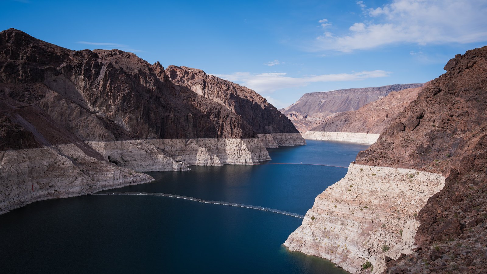
Downstream, Lake Mead recently fell to its lowest level since it began filling about 90 years ago. Together, the two largest reservoirs in the United States are at their lowest combined point since they were created. Interior Secretary Doug Burgum framed the decision in terms of obligation: "The Department has a responsibility to ensure the Colorado River system remains reliable and resilient for the millions of Americans, communities and industries that depend on it."
More than 40 million people across seven states, several tribal nations and Mexico draw on the 1,450-mile river. For about 26 years, warming and drought have delivered less water into the reservoirs than the century-old compact promised, and human demand has not fallen fast enough to match. The rules being replaced expire at the beginning of October.
The reservoirs are also the reason the plan reads as conservative rather than bold. Reclamation's authority over the river is real but bounded: it operates the dams and can decide how much water passes through them, and it can do so in ways that force reductions downstream. What it cannot do is reallocate water rights, which are creatures of state law, interstate compact and a century of litigation. Every additional acre-foot the agency demands raises the probability that a state sues and a court freezes the whole framework — which is why an outline permitting 40 percent cuts produced an order imposing about 20.
Two years, then everyone comes back
The plan announced Friday is the first instalment of a ten-year framework that forces the basin states to renegotiate every two years. Climate and policy researchers have spent years calling for the opposite: a long-horizon agreement with large, permanent demand reductions. This is not that. It is a schedule of recurring emergencies, deliberately structured so that conditions on the ground — snowpack, reservoir levels, politics — can be taken into account as they change.
It is also a standing invitation. Federal officials have said repeatedly that if all seven states reach their own agreement, it can supersede Friday's guidelines. After two years of near-total deadlock, the negotiators most likely to be asked back to the table are the ones least eager to sit at it. "We continue to see a prolonged drought in our future," Travnicek said. "So continuing to work together as a whole within the basin is going to be extremely important."
The deeper reductions are still ahead. Reclamation's framework contemplates the Lower Basin and Mexico losing up to 1.5 million acre-feet in each of 2027 and 2028, and as much as 3 million acre-feet a year beyond 2028 — a volume roughly equal to everything Arizona and Nevada currently receive, and enough to serve more than 25 million people. Friday's plan is not the reckoning. It is the two-year extension before it.
Figures are from the Bureau of Reclamation's announcement of August 21 and reporting by KJZZ, the Associated Press and CNN. Percentage reductions are relative to each state's current allocation.