
Tropical Storm Moke takes aim at a Big Island still digging out of Lala's mud, with up to 15 inches of rain in the forecast
One week after Hurricane Lala killed two people and buried homes under ten feet of mud, a second storm is bearing down on ground too saturated to absorb it. Forecasters say Moke will stay offshore and below hurricane strength — and that it may not matter.
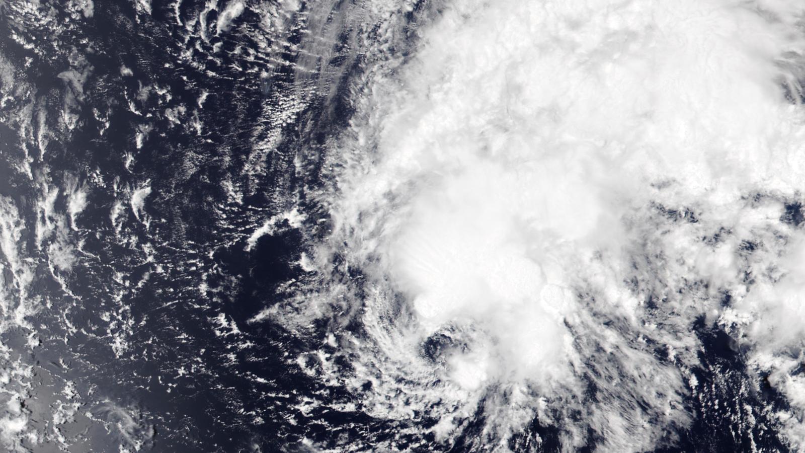
In any other week, Tropical Storm Moke would be a routine piece of Pacific housekeeping — a modest 45-mph system forecast to pass well south of Hawaii without ever reaching hurricane strength. This is not any other week.
Seven days ago, Hurricane Lala skirted the Big Island's southern coast and left behind two dead, 263 damaged or destroyed homes, and hillsides that took in as much as 35 to 40 inches of rain. Now Moke is steering 5 to 10 inches more — locally up to 15 — at the same windward and southeastern slopes, starting late Saturday night. The ground has had one week to drain. It is nowhere near enough.
"It will not take a significant amount of rain to cause flash flooding," the National Weather Service in Honolulu warned Friday, in language that does most of the forecast's work by itself. A flood watch for the entire Big Island runs from late Saturday night through Monday afternoon, and the watch text is blunter still: the rain "may produce life-threatening flooding and mudslides for the windward and southeast portions of Hawaii island, especially in steep terrain and over areas that were affected recently by Lala."
A smaller storm, a lower bar
As of the Central Pacific Hurricane Center's late-Friday advisory, Moke was centered about 545 miles southeast of Hilo, moving west-northwest at 8 mph with maximum sustained winds of 45 mph. Forecasters expect it to peak near 60 mph within a day, then weaken as dry air and wind shear chew at its circulation. The center should pass roughly 225 to 275 miles south of the Big Island between Saturday night and Monday — farther offshore than Lala tracked — and the CPHC puts the likelihood of tropical storm watches or warnings for the main islands at "very low."
"This is not the same as Lala," said John Bravender, the warning coordination meteorologist at the National Weather Service in Honolulu. "Looks like the track is going to be a little further south and the wind field is not as large."
But the meteorology and the danger are two different ledgers. Even passing at a distance, Moke's rain shield reaches the islands: tropical-storm-force winds extend up to 175 miles from its center, and moisture streaming ahead of it will train over the Big Island's windward slopes through the weekend. Islands-wide, forecasters expect sustained winds of 25 to 30 mph with gusts past 40 — near 50 mph downwind of high terrain — peaking Sunday into Sunday evening, along with what the CPHC calls "life-threatening surf and rip current conditions" on exposed east- and south-facing shores. Eastern Maui is in line for 1 to 2 inches of rain, with isolated totals near 4, and 1 to 2 inches could reach the remaining islands into Monday.
Forecasters' confidence in that offshore track is unusually high — the model guidance is tightly clustered — but rainfall is a different ledger. The 15-inch maximum only verifies if training bands stall over the windward slopes, and the placement of the heaviest rain remains the real wobble in this forecast. On ground this saturated, even the low end of the range is enough to send debris flows down Kaʻū's steep terrain, which is why the impact uncertainty is running well ahead of the meteorological kind.
What Lala left behind
The reason a mid-grade tropical storm has the state's full attention is what it is landing on. In Naalehu, in the Big Island's Kaʻū district, Lala's floodwaters buried homes under as much as 10 feet of mud and tore through the community cemetery — 69 sets of remains have since been recovered. Naalehu Elementary and Kaʻū High remained closed and without power at week's end, and about 11,290 Big Island customers were still in the dark Friday morning. Roughly 60,000 lost power at the storm's height.
The recovery machinery was still arriving as Moke approached: the Hawaii National Guard spent Friday pre-positioning assets, FEMA assessment teams deploy this weekend, and joint preliminary damage assessments — the paperwork that unlocks federal disaster aid — begin next week, likely in the rain.
After what we experienced with Lala, we are not going to take anything for granted.
That was Honolulu Mayor Rick Blangiardi on Friday, acknowledging that the forecast for Oahu is "certainly moving in a better direction" while declining to relax. It is the posture of the whole state: officials are treating a 45-mph storm like a serious threat precisely because last week's serious threat used up all the margin.
The quiet ocean and the loud one
Moke is also the latest data point in the strangest split-screen of the 2026 hurricane season. The Central Pacific has now produced back-to-back cyclones affecting Hawaii in consecutive weeks — Lala, remarkably, is still alive as a weakening 85-mph hurricane far to the northwest — and the eastern Pacific pipeline remains busy, with one disturbance given 80 percent odds of development over the next week, though none is currently forecast to threaten Hawaii.
The Atlantic, meanwhile, has managed two weak named storms all season and not a single hurricane. The culprit for both patterns is the same: a record-strength El Niño that pumps energy into Pacific development while shredding Atlantic systems with wind shear. NOAA's August update cut its Atlantic forecast to 7 to 13 named storms and gave the season 75 percent odds of finishing below normal.
The same update called for just two to six Atlantic hurricanes and at most two major ones, numbers trimmed from the agency's May outlook after the season's near-silent first half. The clearest reading of both oceans is the simplest one: this El Niño is running the show, and it has chosen its side of the planet.
Forecasters are not writing the Atlantic off — the season's climatological peak falls on September 10, the National Hurricane Center is tracking three weak disturbances with development odds of 20 to 30 percent, and late August is historically when long-track waves rolling off Africa begin to matter. But for now the calendar says wake up and El Niño says otherwise. Behind Moke, the CPHC expects no new Central Pacific development for at least seven days — a window Hawaii intends to spend digging.
The sequence for the weekend is set. Saturday: rising surf on east-facing shores, first rain bands arriving late. Sunday: the worst of it — heaviest rain over windward and southeastern Big Island, peak winds statewide, the storm's core making its closest pass. Monday: rain spreading to Kauai as Moke pulls away and the flood watch expires in the afternoon. Then, if the forecast holds, a stretch of quiet the state has not had since the first week of August.
Storm figures in this article are from the Central Pacific Hurricane Center's Advisory 8, issued 11 p.m. Hawaii time Friday, the latest available at publication; advisories are updated several times daily at nhc.noaa.gov.